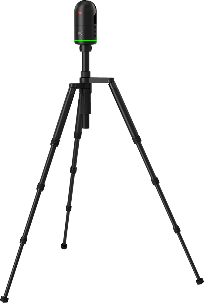
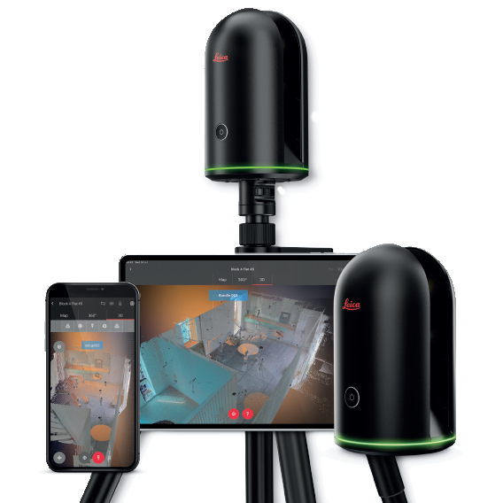
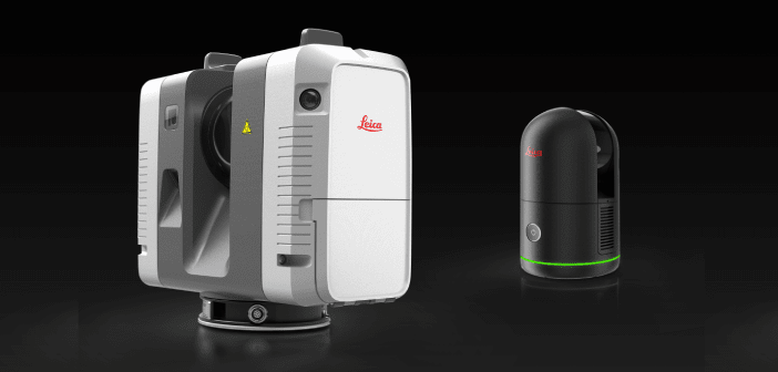
3D Scanner
3D laser scanner survey services
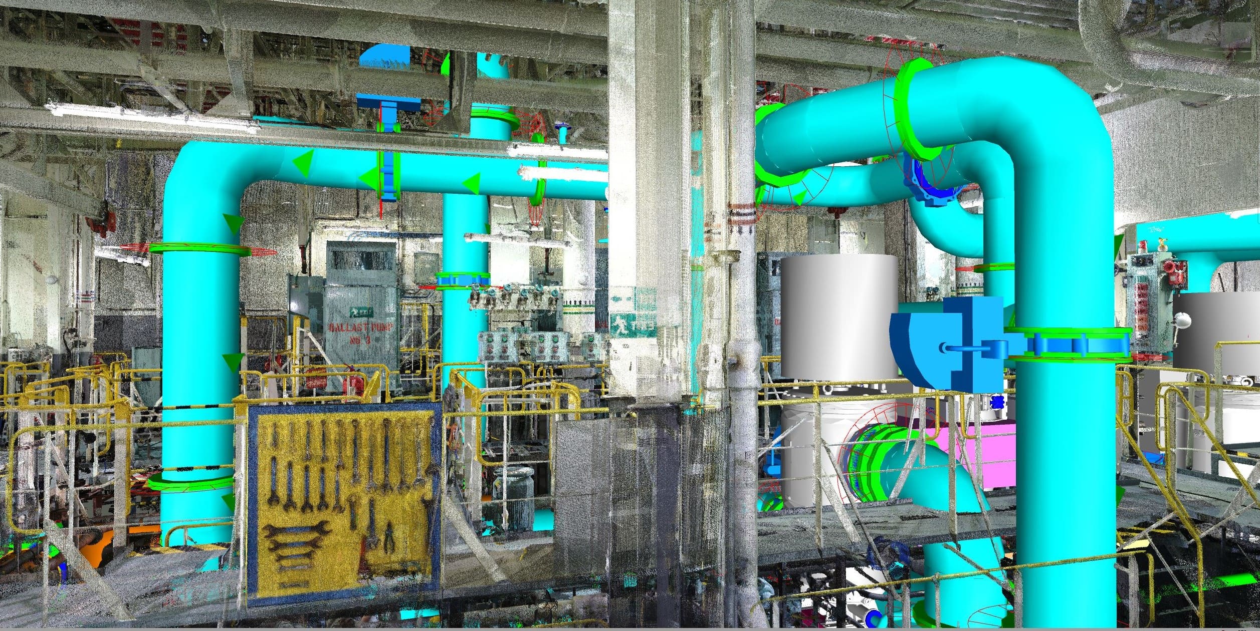
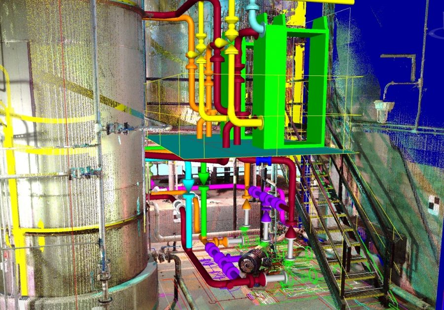
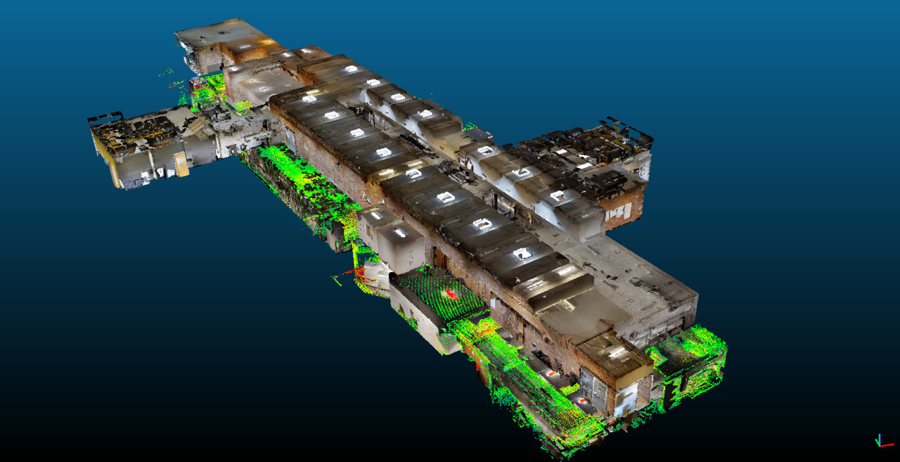
Laser scanner surveying makes it possible to capture the geometry of surfaces and create a mapping enriched with High Dynamic Range (HDR) images. It records the as-is state of objects, environments, and structures. The survey is fast and highly accurate, transforming reality into a digital model: the point cloud. The scanned object is geo-referenced with longitudinal, latitudinal, and altitudinal coordinates, along with length, width, and height measurements.
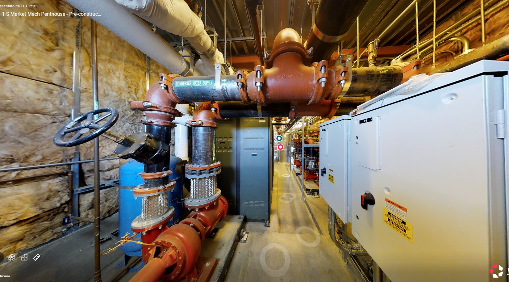
In the post-survey phase, the point cloud is processed and cleaned with dedicated software. A virtual object is generated that can be read by any parametric design software, from which floor plans, elevations, sections, 2D and 3D views can be extracted. Virtual tours of interiors and exteriors, video editors, aerial and exploratory views can also be produced.

Who it is for
Architects and architectural firms; Civil, Forensic, Environmental, Mining, and Naval Engineering. Applicable in industry, infrastructure, land management, energy, cultural heritage, and construction.
Work Customization
Depending on the environment and client requirements, we offer:
– Machine rental service without operator (NSC).
– Scanning service with operator (NCC) with delivery of the native point cloud and scan report.
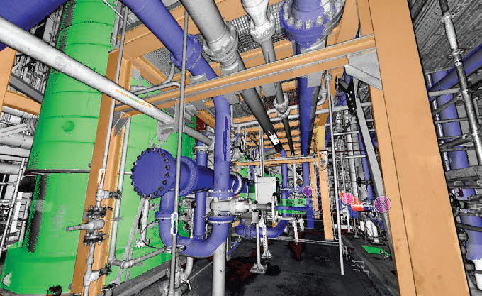
– Conversion service of scans into Mesh: cleaning distortions, reflections, and noise; the project becomes measurable.
– Aerial photography, virtual video tours, video editing, and extraction of detailed images.
– TreeView for corporate websites, surface measurability and screen consultation, also available for Virtual – – Reality headsets.
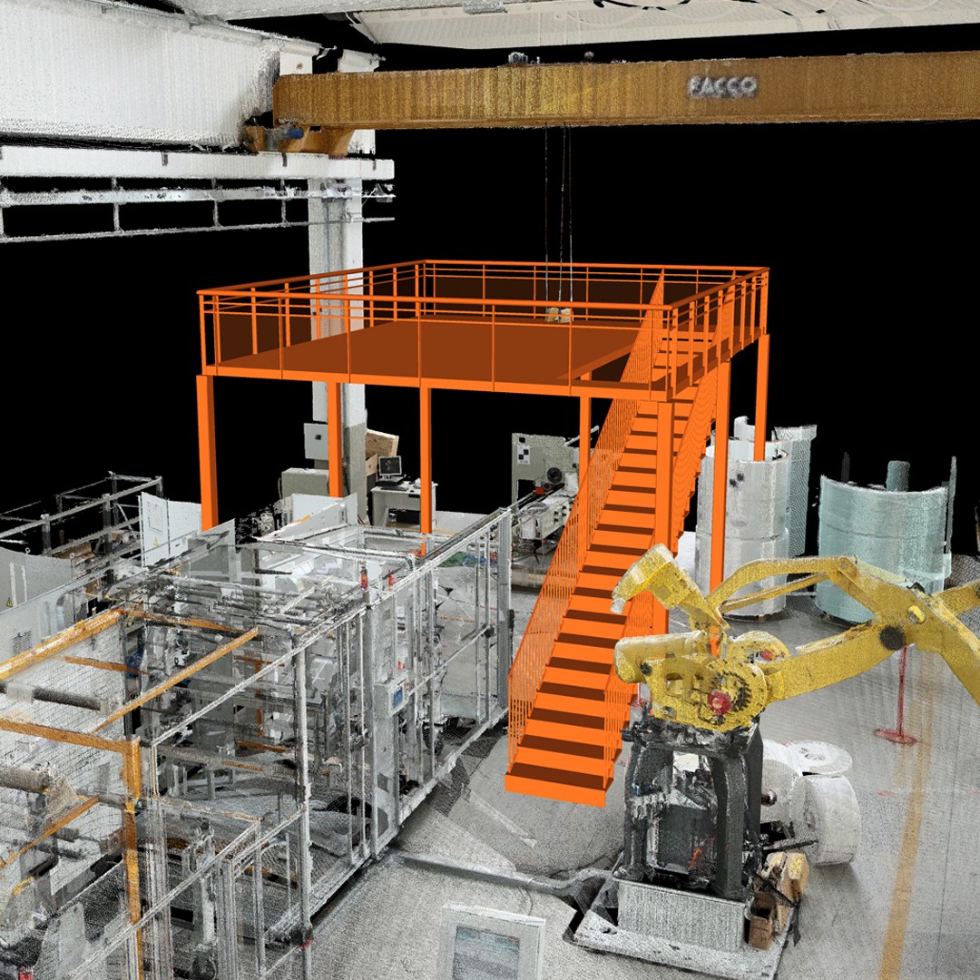
– CAD graphic rendering with 2D and 3D project of the surveyed object (only for industry and infrastructure).
The Team
Expert technicians at your service for 3D surveys, point cloud reprocessing, detailed 2D/3D model creation, finalized for BIM construction projects, renovations, technical archive inventories, and tagging of machine parts for disassembly and reassembly.
Technology
The 3D Laser Scanner (LiDAR – Light Detection and Ranging) allows acquisition and mapping of indoor and outdoor surface geometries, capturing High Dynamic Range (HDR) images and generating a point cloud.
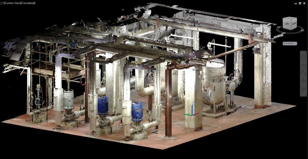
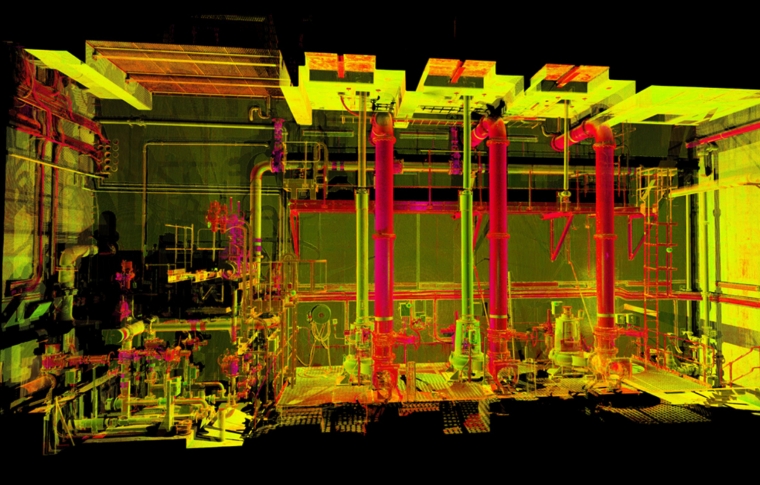
The resulting 3D Point Cloud becomes a three-dimensional map where every visible surface can be measured.
The fast acquisition of data, images, information, and details optimizes repeated manual measurements, saving time and costs for the client.
Scans provide:
- A Point Cloud (native 3D data);
- A photo-realistic 3D floor plan, measurable and navigable with free software;
- Millions of HDR Photos;
- Orthophotos (aerial photographs with orthographic projection);
- Identification/description markers (labels for electric motors, piping lines and flow direction, electrical cabin numbers, coordinates, etc.) useful for machinery disassembly/reassembly and component identification;
- Reverse Engineering for prototyping, 3D printing, documentation, analysis and design;
- Cost-benefit ratio optimization;
- Certified scan reporting;